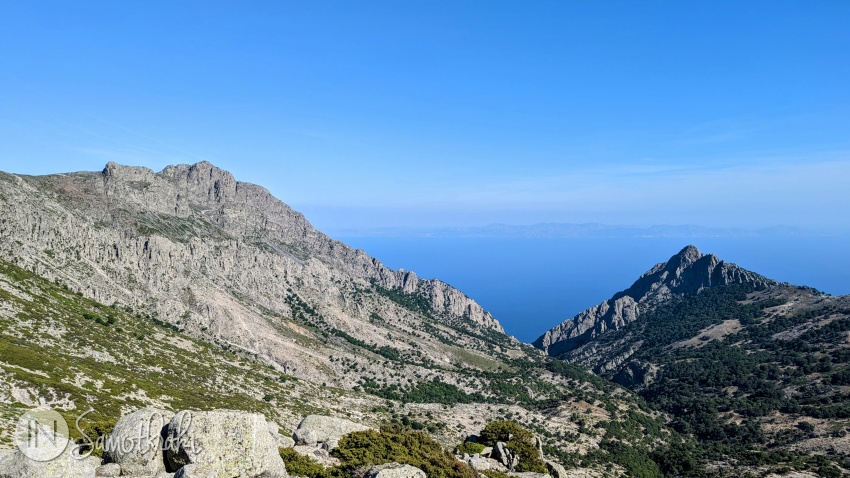
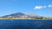
It is often said that Samothraki is not an island, but a mountain soaring from the middle of the sea. The name of the mountain is Saos. You can see it from afar, from the ferry, with its succession of sharp, pyramid-shaped peaks rising steeply from the Thracian Sea.
The mountain, made up mainly of granite and basalt, takes up most of the island, influences the microclimate and dictates the layout of the settlements and the lifestyle of the inhabitants.
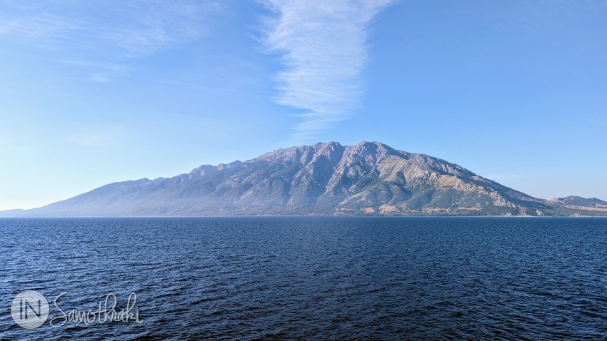
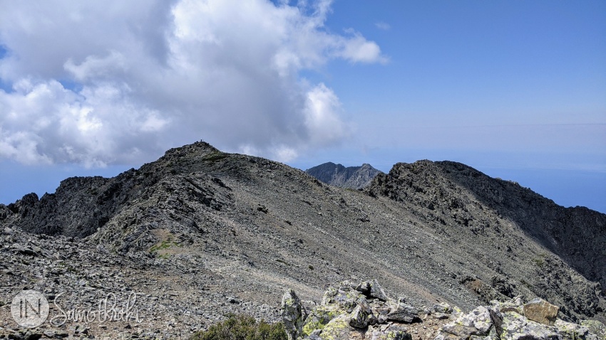
Samothraki is the third highest island in the Aegean Sea, after Crete (Psiloritis peak, also known as Ida, 2456m) and Evia (Dirfys peak, 1743m). The highest peak of Mount Saos is Feggari or Fengari (1614m) - meaning "Moon". It is said to be so tall that it covers the moon.
In the "Iliad", Homer mentions the peak of Feggari, telling about how Poseidon, the god of the sea, watched the Trojan War from the highest peak of Samothraki.
"... But mighty Earthshaker Poseidon was keeping watch.
High on the tallest crest of wooded Samothrace
he sat looking down upon the war going on.
From that point, Mount Ida was clearly visible,
Priam's city, too, and the Achaean ships."
(Homer, Iliad: Book 13)
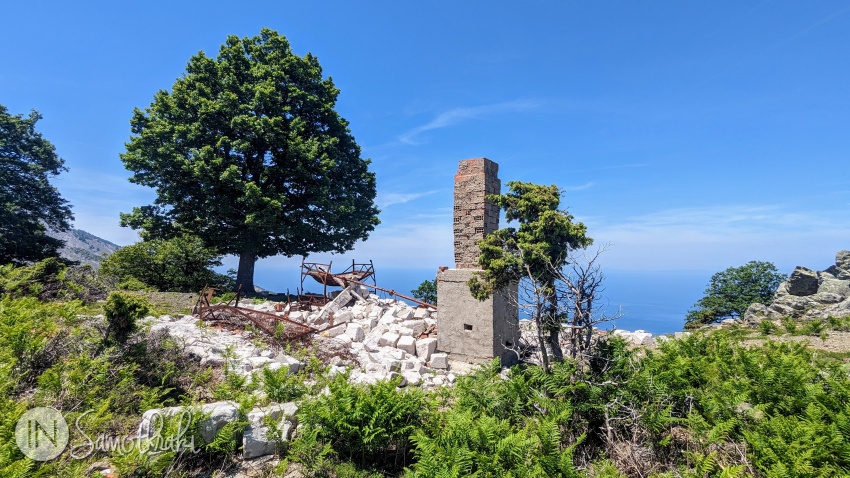
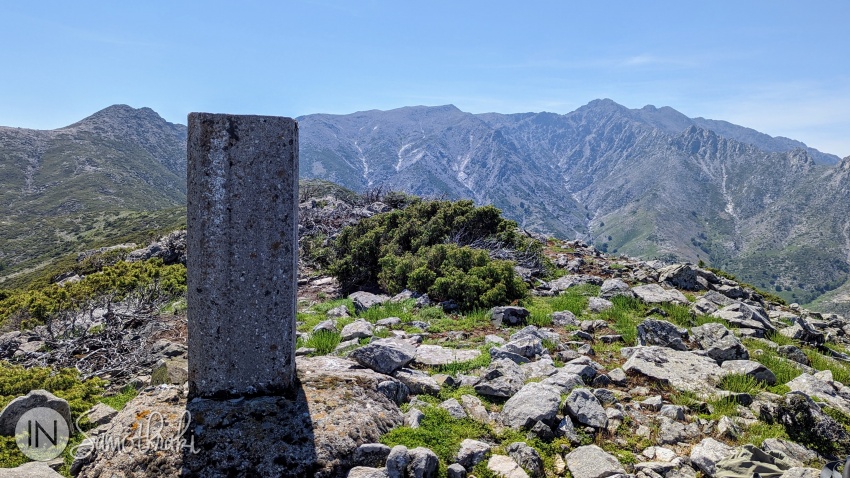
Other important peaks are Marmaras (1611m, often confused with Feggari and also nicknamed Kolonaki, because of the geodetic marker), Louloudi (1475m), Ai Giorgos (1455m), Ai Lias (1403m), Pyrgoudis (1260m), Akoniama (1224m), Amoni (1200m), Afaki (1191m), Vounos (1141m) and Koufouklio (1074m, where there used to be a mountain refuge, today in ruins).
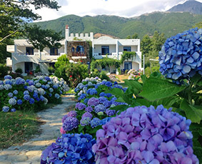
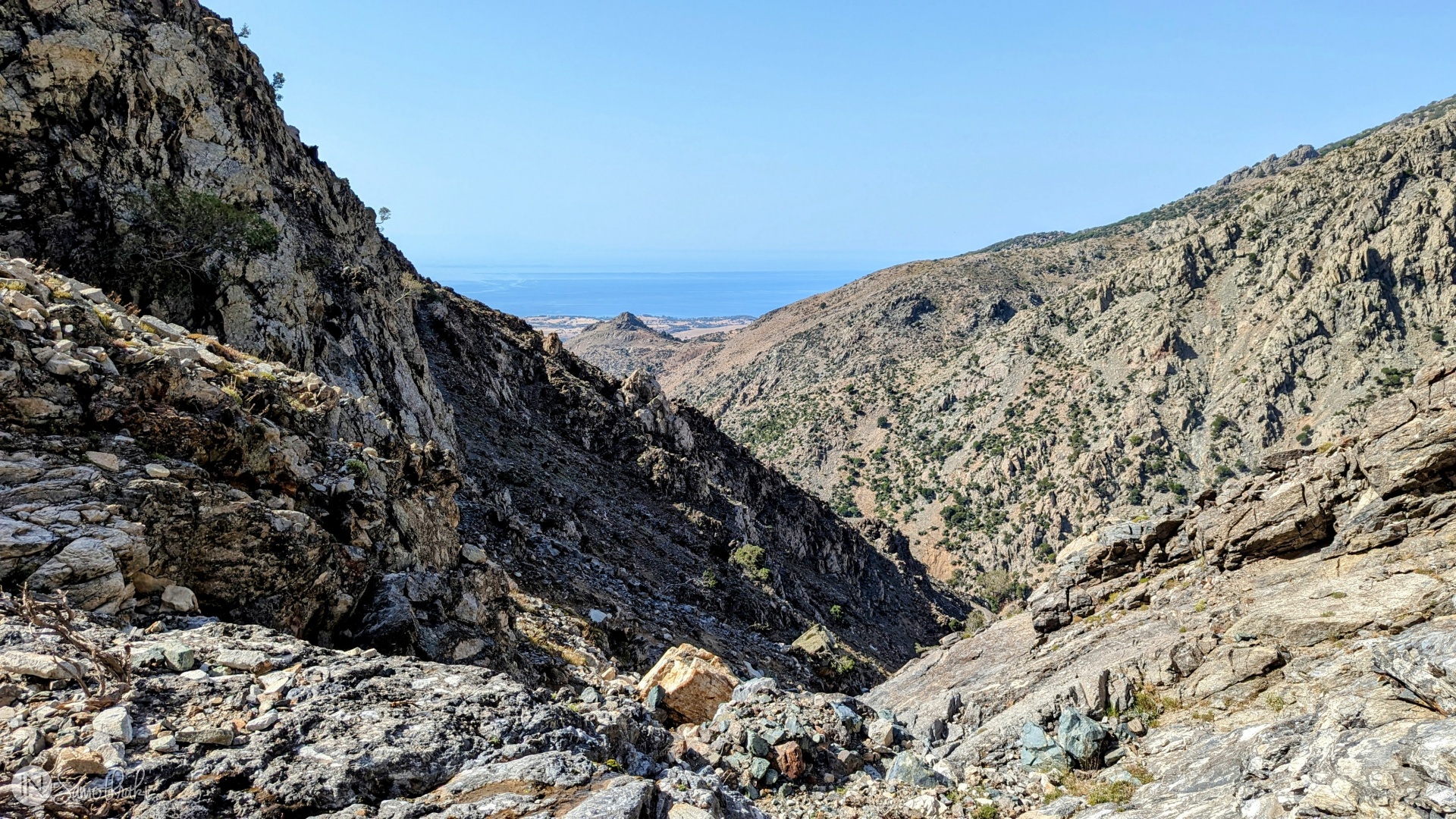
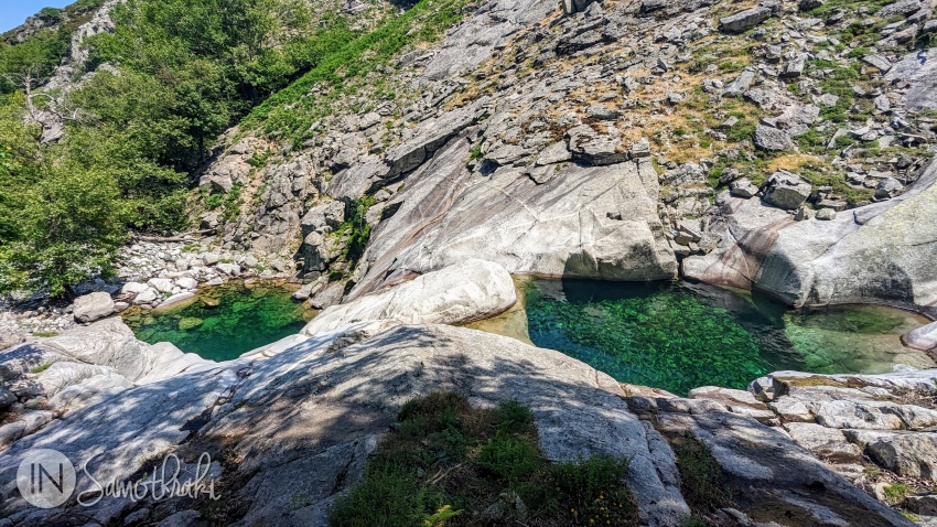
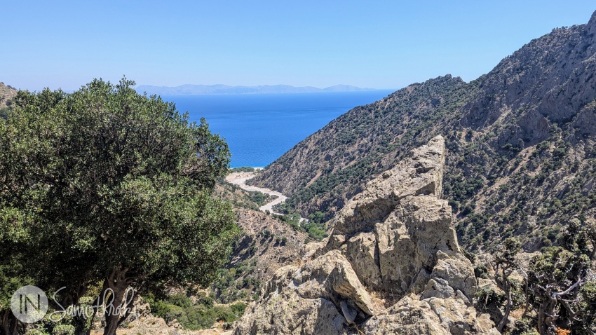
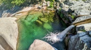
If you like hiking and climbing, then Samothraki is for you. The mountain, the countless rivers with waterfalls and vathres (natural pools), the rich vegetation of the north with centuries-old oak and plane trees, the wild ridges and the steep slopes are what the island is all about, more so than the beaches.
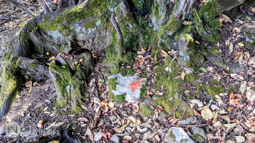
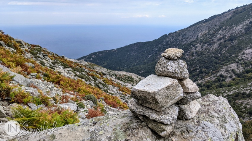
The trails on Mount Saos are of varying degrees of difficulty, but too few are marked, and on some of them, the signs (red dots, supplemented in places with stone piles) are barely visible.
The most popular paths are the easy, accessible ones, that go to the first vathres on the rivers Fonias, Platia and Tsivdogiannis (Paradisos). More difficult (and often harder to find) are the trails that take you to the area of the springs of the Fonias River (Karya area) and Platia (Kouriat area), but also to the gorges of the Karagiannakis, Kousiandas and Vatos rivers.
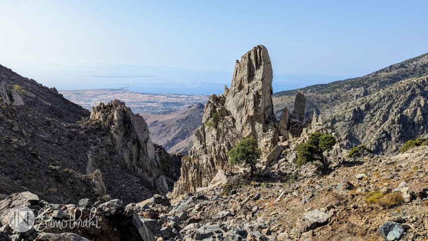
The trail to Feggari Peak is the European trail E6, which starts from Therma. It is a long (about 10-11 hours for the round trip) and difficult hike due to the large difference in altitude and the climb over boulders in the last part. You need to pay close attention to the signs and navigate technical sections on the ridge. There are other ways to get to the top from Chora or other parts of the island, but they're even more dangerous and demanding.
A shorter, but quite difficult path, which requires some experience with climbing, is the one that connects Pachia Ammos Beach to Vatos Beach. The alternative is to go from Panagia Krimniotissa, but you most likely won't find your way without a guide.
Other peaks, caves or prehistoric settlements can be reached, though, it's advisable to go with someone who knows the island. If not, you'd better have some mountaineering experience, preferably from wandering around Samothraki, so you understand its topography and the dangers you expose yourself to.
Whichever trail you go on, bring a hat, sunglasses and appropriate mountain footwear and clothing. Steep slopes and makeshift paths covered with unstable gravel and sand are commonplace in Samothraki. If you're attempting high-altitude trails, take plenty of water with you, as well as warm clothes. Strong gusts of wind are a common occurrence in most seasons, the weather could change swiftly and water sources may not exist after a certain altitude.
Do not venture up the mountain if you do not know the way or are not together with someone experienced! Accidents (with fatal endings oftentimes) happen every year in Samothraki. Don't be the guy or gal who walks barefoot in the forest, and then, 15 minutes later, has an open wound after slipping and hitting a sharp rock.

 The Waterfalls and Vathres of Samothraki
 Boat Trips in Samothraki
 10 Things to Do in Samothraki
 Where the Island Ends: Akrotiri Cape and Agios Andreas Lagoon
 Hiking the Fonias River Up to the Kleidosi Waterfall